 koko
koko When in IcelandSeven days around the ring road
- 2 people
- You are doing the driving
- October, winter's front edge
- Nothing longer than an hour on foot
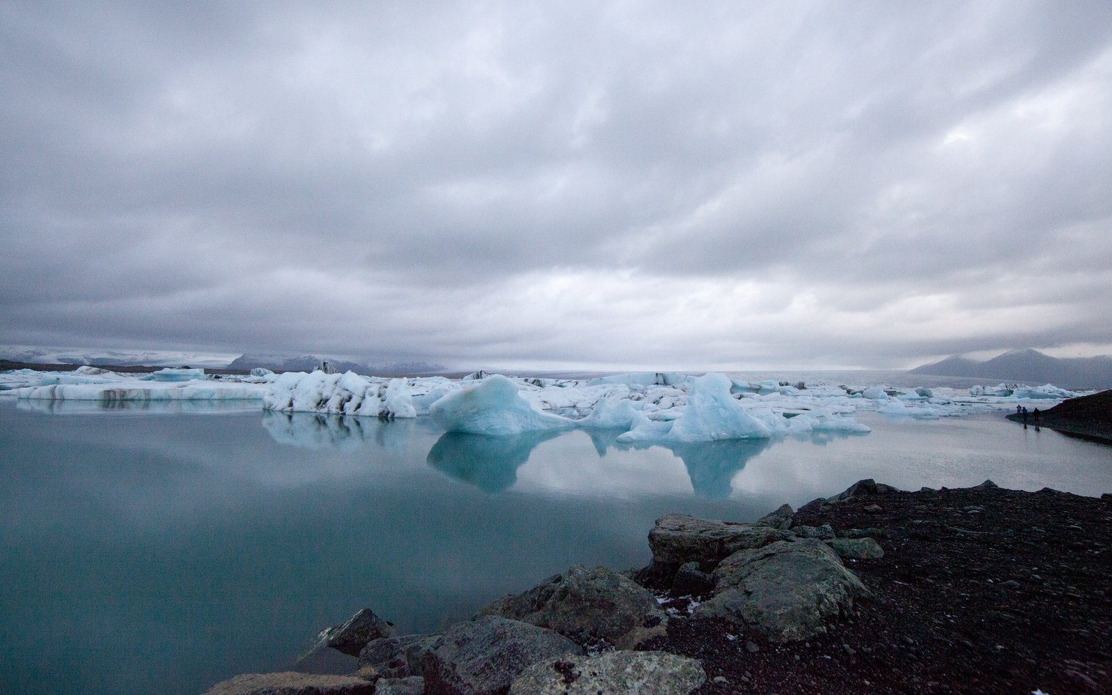
Two of us, one car, seven days, one lap of the country. Anticlockwise.
Iceland is small enough to lap in a week and empty enough that the driving is the good part, not the price you pay for the good part.

We went in October. That decision shapes everything below, and not in the way most people expect, so it gets its own section before the itinerary starts.
Read this before you go
Things you need to know
| Item | USD | |
|---|---|---|
| Flight from Toronto | $430 to $625 | |
| Car rental for seven days, two sharing | $210 to $280 | |
| Hotel, two to a room 7 × $125 | $875 | |
| Food 7 × $100 | $700 | |
| Gas, two sharing 7 × $25 | $175 | |
| Activities and entries 7 × $50 | $350 | |
| Total | $3,005 |
The roads are the whole plan
There are two kinds of road here and the difference decides your whole trip.
Route 1, the ring road, goes around the outside of the country. Paved, open all year, and it is the spine of everything below. The F-roads go into the interior. Unpaved mountain tracks, legally 4x4 only, and open roughly three months a year.
If that is what you came for, come in July or August and give it a full day, or pay somebody with a super jeep to worry about the river crossings for you. Even a legal 4x4 is not insured for those: water damage sits outside standard CDW, and Reykjavik Rent a Car's own F-road page lists engine damage, electrical failure and full vehicle recovery as the normal outcomes of getting one wrong.
Two smaller seasonal traps on the same lap. Road 864, the gravel east bank at Dettifoss, runs from late May to early October only, so take road 862 on the west bank, which is paved and open April to December. And route 93 over Fjardarheidi to Seydisfjordur is the first pass in the east to shut in bad weather.
October is the start of winter, not the end of autumn
Get this straight before you book anything. Icelanders treat October as the front edge of winter, and the country behaves accordingly.
The light goes, fast. On 1 October the sun is up in Reykjavik at 07:37 and down at 18:54, so about eleven and a half hours. By 31 October it is up at 09:09 and gone by 17:12, which is eight. You lose three and a half hours of daylight inside one month, and this itinerary is built on daylight, because the whole point is looking out of a windscreen.
The highlands are shut. Not risky, shut, as above.
The ring road stays open, which is what saves the trip, but expect ice on bridges and passes, expect the odd pass to close for a day, and expect real wind.
Nearly every stop charges to park
This is the line everybody gets wrong. Almost every major stop now charges 700 to 1,200 ISK to park, and there is no single system. Parka, EasyPark and checkit.is each own different car parks, and none of them talk to each other.
The damage on this route: Geysir, Skogafoss, Reynisfjara and Kirkjufell about 1,000 ISK each. Seljalandsfoss 1,000. Thingvellir about 1,000. Skaftafell 1,040, and it halves your Jokulsarlon parking if you do both the same day, so do both the same day. Kerid charges 700 ISK a head instead of per car, because it is privately owned rather than state-run. Gullfoss is the one major stop still free.
Then there is the road charge. Since January 2026 Iceland bills 6.95 ISK per kilometre in place of the old fuel tax, and your rental company adds it to the final bill. This lap is over 2,000 km, so it is a real line on the invoice. The good news nobody mentions: petrol got cheaper at the same time, down to roughly 210 to 220 ISK a litre.
What a week actually costs
The card above is the real budget. My working, so you can argue with it:
A hundred a day for food. Fifty for petrol. Fifty for things you actually do. Two hundred and fifty a night for a room, which is honest, though two hundred is gettable if you book early. Two people splitting the car and the room lands around three thousand US dollars a head including the flight.
It is costed for two because that is what we were. Every extra body halves the car and the petrol again without touching food or tickets, so four is cheaper per head.
Before you leave home
- Sort the border admin Since October 2025 non-EU arrivals are fingerprinted and photographed at Schengen borders, and ETIAS is expected late 2026.
- Book a real 4x4, not a Golf A 2WD on an F-road is illegal and voids your insurance outright.
- Book Silfra early It is a guided dry suit tour with a hard minimum age of 12, and slots go.
- Book the Blue Lagoon Timed entry only. There are no walk-ins, and slots sell out.
- Install the parking apps Parka, EasyPark and checkit.is, all three, with a card saved.
On the road
- Check umferdin.is every morning Road status and closures, and it is the only source that matters for F-roads.
- Check vedur.is for wind, not rain Iceland's wind rips car doors off their hinges. That is not a joke, it is an insurance exclusion.
- Fill up above half a tank In the east and north the gaps between stations are long.
- Headlights stay on Day and night, all year. It is the law.
Day 1: Land, and take Reykjavik slowly
The flight lands in the morning and you are going to want to start driving immediately. Do not.
Pick up the car, drive the 50 minutes into Reykjavik, and write the day off. You have maybe nine hours of light, tomorrow is the biggest day of the trip, and Reykjavik is small enough that a slow afternoon covers basically all of it.
The two hour walk that covers the city
Start at Hallgrimskirkja, the concrete church on the hill you can see from almost anywhere in town. Pay the 1,500 ISK for the tower. It is the only high vantage point downtown, you cannot pre-book it, and it orients you for everything else.
Come down Skolavordustigur, the street painted as a rainbow, permanently so since 2019. It runs from the church into Laugavegur, which is the main line of shops and bars. Carry on to the water for the Solfar, the steel ship sculpture everyone photographs, then follow the shore to Harpa, the black glass concert hall on the harbour. That is the centre of the city, end to end.
Do the one thing tourists skip
Where to eat
Cheap and obligatory: Baejarins Beztu Pylsur on Tryggvagata, a hot dog stand that has been running since 1937. Ask for eina med ollu, one with everything, which means raw onion, crispy fried onion, ketchup, sweet mustard and remoulade. It is open until 01:00 most nights and 06:00 on Friday and Saturday.
Dinner: Messinn on Laekjargata. Icelandic seafood served in the cast iron pan it was cooked in, mains from around 4,000 ISK, and it is the right level for a first night. You are tired, you want fish, you do not want a tasting menu.
Day 2: The Golden Circle and the south coast
This is the long one. Roughly 350 km, eight stops, and the day that sells people on Iceland. Every stop on it is worth opening the door for, and it is the day where an early start genuinely matters.
Geysir and Strokkur
Start here rather than at Thingvellir, which you will come back to on the last day anyway. The Great Geysir that the English word comes from has been more or less dormant since 1916. It is Strokkur, the smaller one next to it, that performs now, every five to ten minutes, and the crowd's collective flinch when it goes is half the fun.
Tap to revealHow they used to force an eruption
Soap powder lowers the water's surface tension so it boils more easily, and for decades people poured it into Geysir to make it spout on cue, famously by the ton for a visit from the Danish king in 1907. It works, and then it clogs the vent, which is a fair part of why the Great Geysir stopped.
Gullfoss
Ten minutes up the road. The river turns a corner and drops twice into a canyon deep enough that the bottom is just spray from the top. Walk the lower path first for the scale, the upper one for the shape.
Kerid crater
A 3,000 year old crater with a flat, unreasonably green lake in the bottom. Small, quick, and the one place on this route that charges per person instead of per car.
Seljalandsfoss and Skogafoss
The two south coast waterfalls, half an hour apart, and they are completely different animals. Seljalandsfoss you walk behind, on a path that loops around the back of the water. Skogafoss you walk up to until you cannot stand the spray, then climb the staircase up its right-hand side.
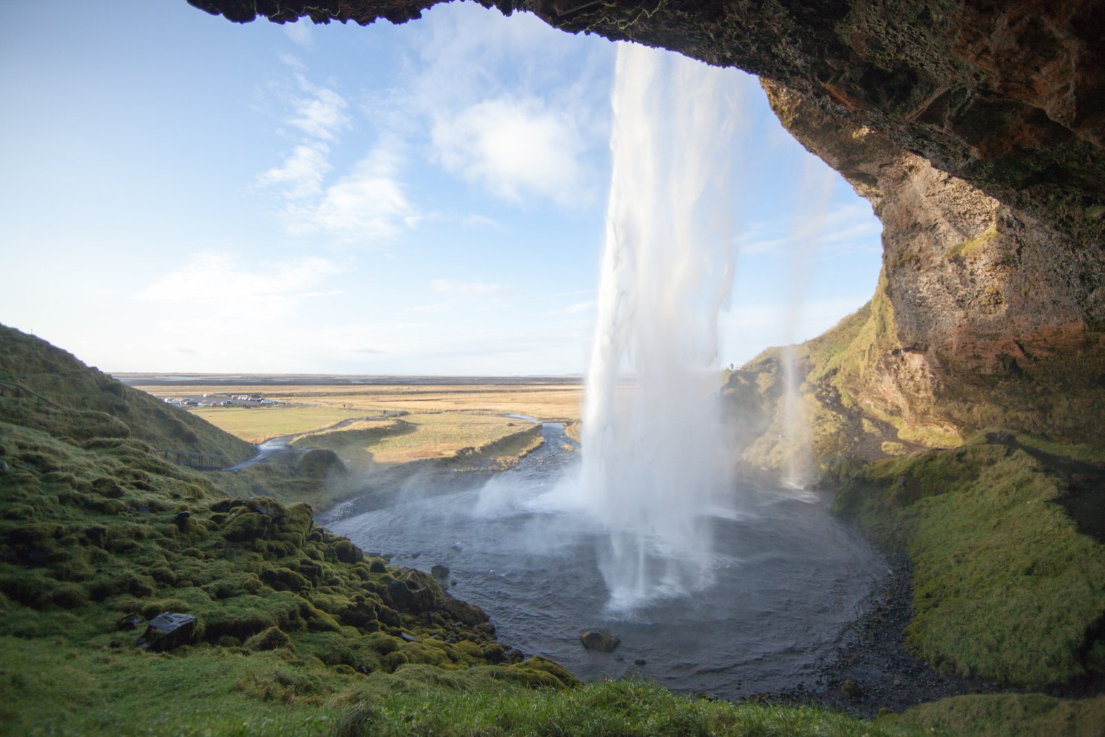 Behind Seljalandsfoss, looking back out through the water at the flat farmland
below. This is the whole reason to stop here.
Behind Seljalandsfoss, looking back out through the water at the flat farmland
below. This is the whole reason to stop here.
Dyrholaey, Reynisfjara and Vik
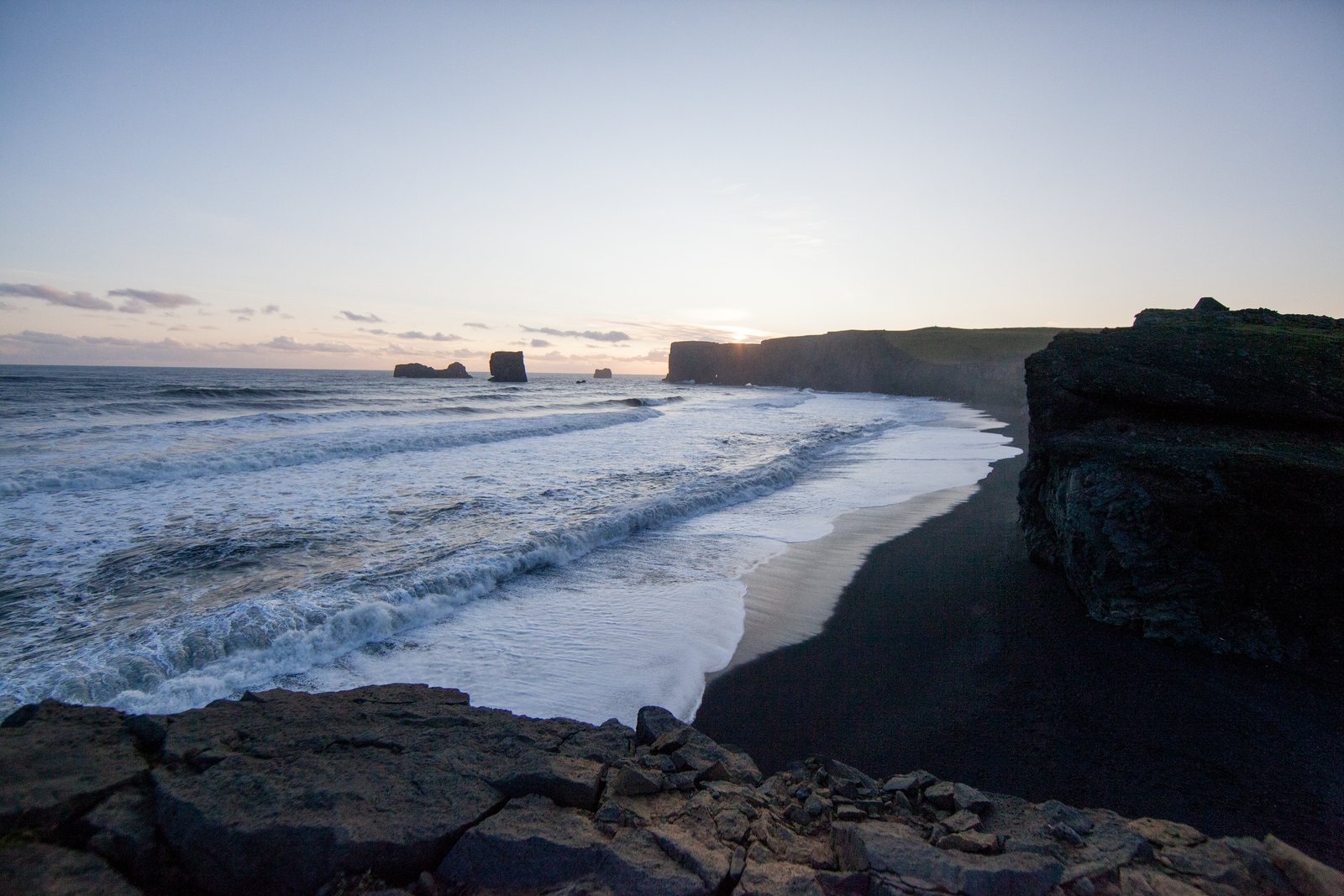 The view west from Dyrhólaey. Black sand the whole way, stacks out in the water,
and the sun already going at four in the afternoon.
The view west from Dyrhólaey. Black sand the whole way, stacks out in the water,
and the sun already going at four in the afternoon.
Dyrholaey is a headland with a stone arch punched clean through it, and a rough gravel climb up to the lighthouse for the view along the whole black coast. In October it is fully open. The upper road closes for nesting from mid May to late June, which is also the only window the puffins are there, so you cannot have both.
Then Reynisfjara, which is the most beautiful and the most dangerous place on this list.
Sleep in Vik. It is the only town of any size for a long way in either direction.
Day 3: The southeast, and the glacier lagoon
An easy one after yesterday. Roughly 285 km, and the scenery does all the work.
Fjadrargljufur
A hundred metre gorge with a river snaking along the bottom of it, twenty minutes off the ring road past Kirkjubaejarklaustur. The walk along the rim is flat and takes about half an hour.
Skaftafell
The corner of Vatnajokull National Park under Europe's largest ice cap, and the trailhead for Svartifoss, the waterfall framed by black basalt columns. About an hour up, and worth it.
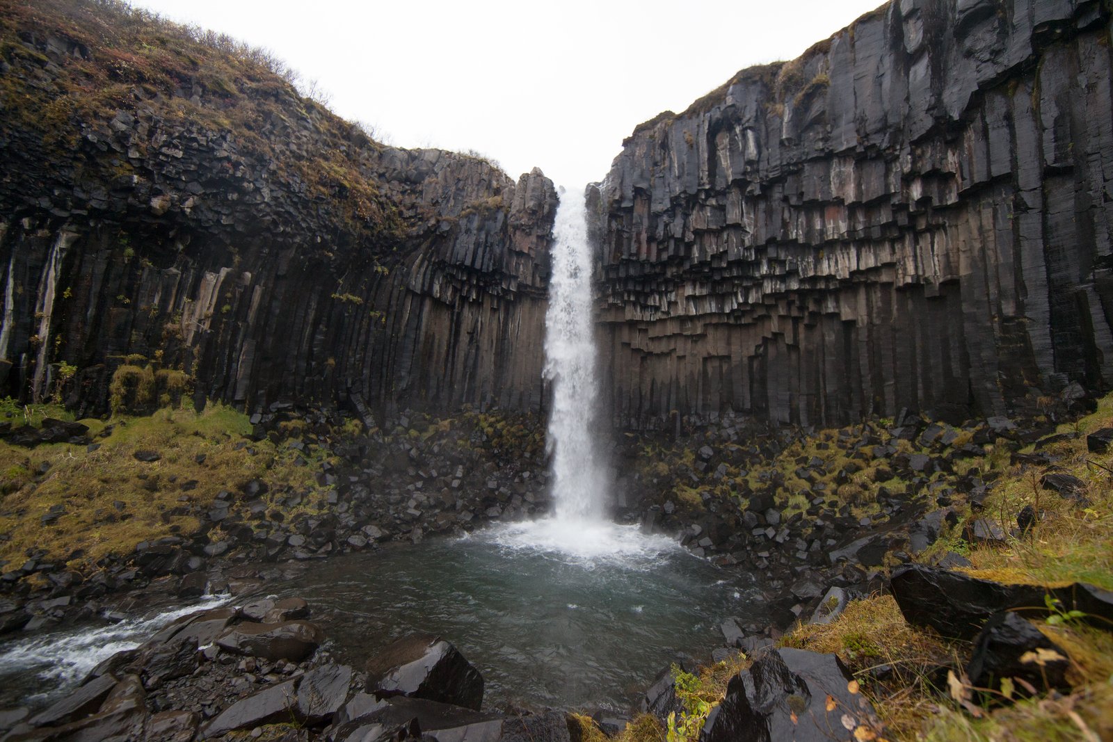 Svartifoss, an hour's walk up from the visitor centre. The columns are what
basalt does as it cools.
Svartifoss, an hour's walk up from the visitor centre. The columns are what
basalt does as it cools.
Jokulsarlon
The glacier lagoon. Icebergs calve off the tongue of the glacier, drift across and go out to sea, and some wash straight back onto the black sand across the road.
Sleep in Hofn
Iceland's langoustine town, an hour further on. Pakkhus in a converted harbour warehouse and Humarhofnin down the road both do the same thing, which is langoustine tails in garlic butter, from about 6,500 ISK for a half dozen. Best meal on the route.
Day 4: Up the east fjords
About 220 km, and the emptiest, strangest driving of the week.
Hvalnes and Eystrahorn
An orange lighthouse on a black pebble spit under Eystrahorn, a jagged gabbro mountain that looks like it belongs in another country. A fifteen minute stop that most people drive straight past.
Egilsstadir and Seydisfjordur
The ring road climbs inland over the fjord passes to Egilsstadir, the junction town everything in the east runs through. Then you turn off it for Seydisfjordur, and that turn is the one decision on this day that can actually go wrong.
Worth crossing for. Seydisfjordur is a tiny fjord town with a rainbow street painted up to a pale blue church, and it is the most photographed thing in east Iceland for good reason. Bjolfur stands over the whole thing: in summer you can get up it, on the 4x4 track past the avalanche barriers or the signed 5.8 km hike from the Stafdalur ski lodge. In October you look at it from the bottom.
Day 5: The Diamond Circle to Akureyri
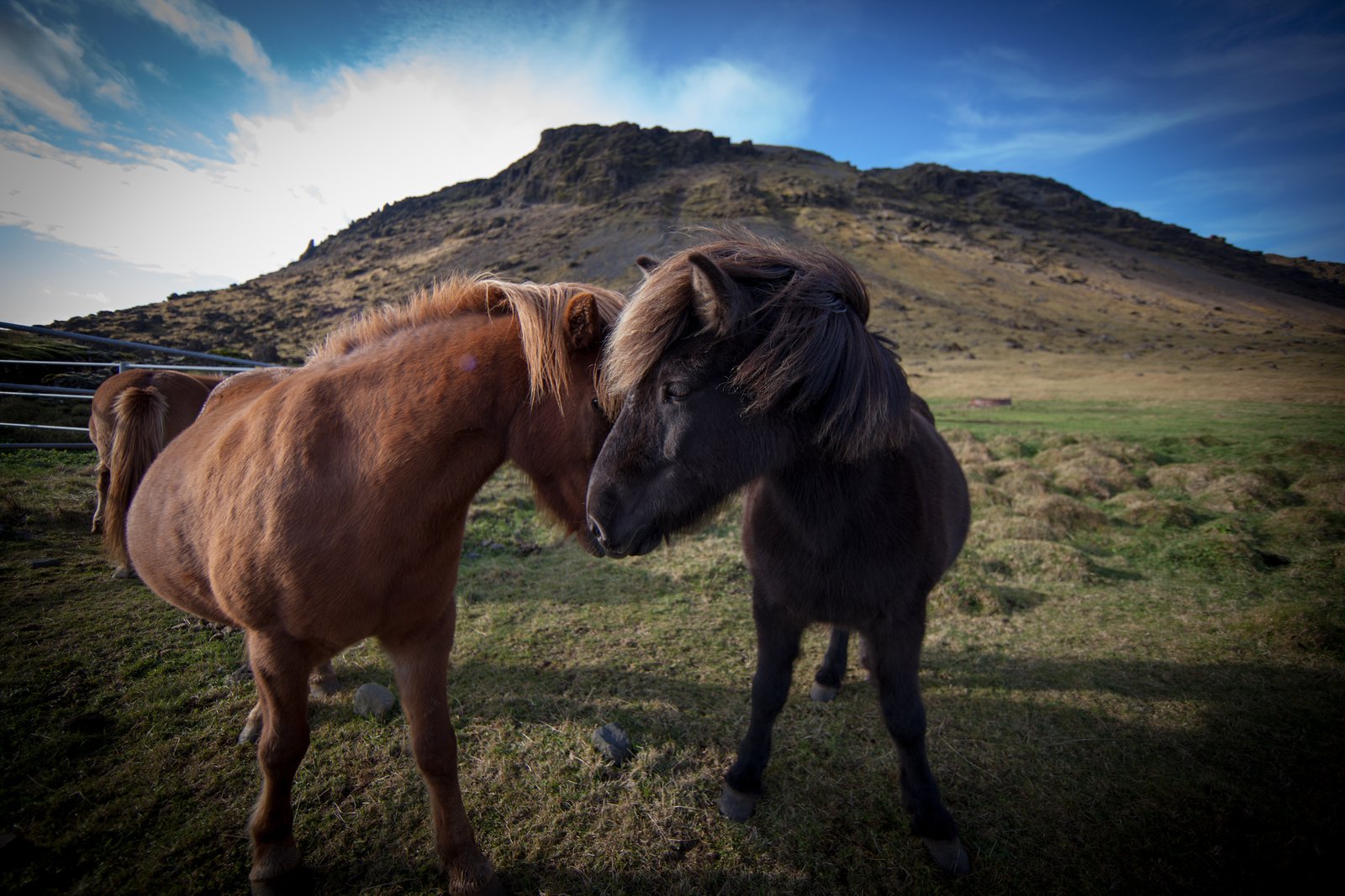 They come to the fence on their own. Every long driving day on this route has a
version of this in it.
They come to the fence on their own. Every long driving day on this route has a
version of this in it.
The stretch from Egilsstadir to Asbyrgi is the emptiest driving on the lap, so start early. Asbyrgi is a horseshoe canyon with a wooded floor, which in Iceland is a genuinely strange thing to walk into. Norse legend says it is a hoofprint left by Odin's horse. The flat path to the pond at the closed end is the walk to do.
Then Dettifoss, the most powerful waterfall in Europe, which you can hear from the car park. Take road 862 on the west bank.
Myvatn afterwards is a shallow volcanic lake surrounded by pseudocraters and steam, with Dimmuborgir next door: a collapsed lava lake left standing as pillars, arches and hollow towers. The short Kirkja loop takes about half an hour.
Finish in Akureyri, the north's only real city, at the head of a long fjord.
Day 6: The long way home, via Snaefellsnes
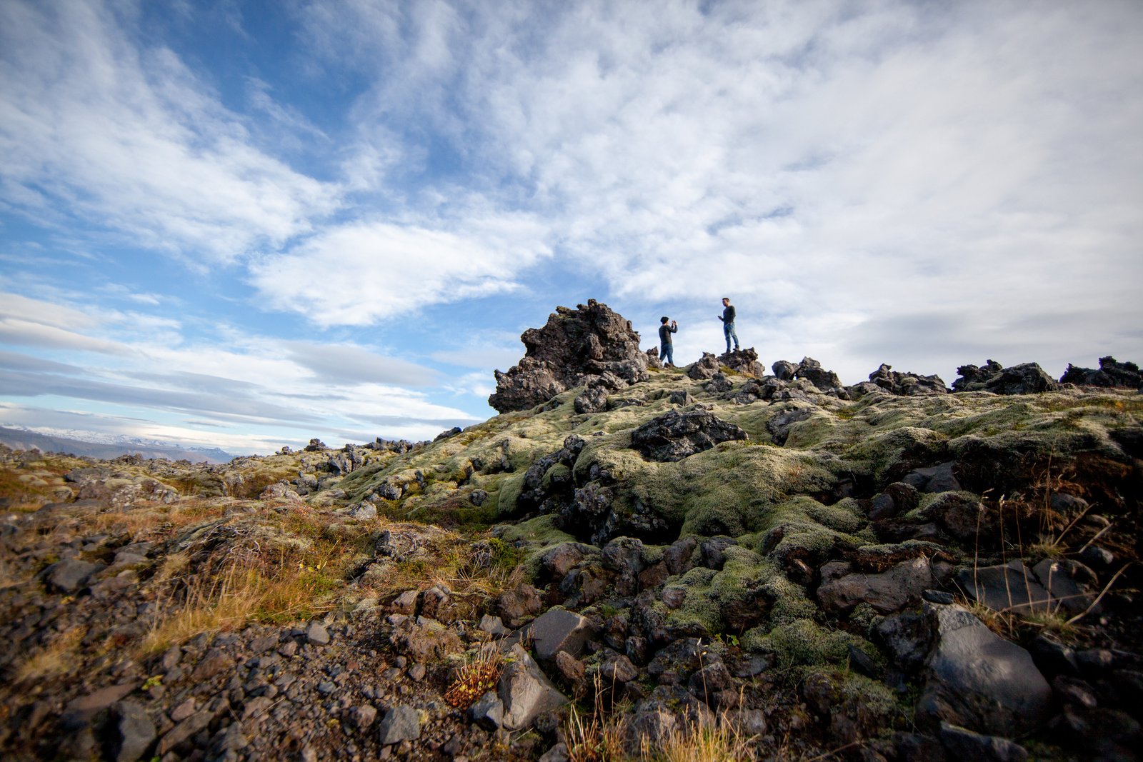 The lava fields on the peninsula are carpeted in moss a foot deep. Walk on it and
the scar stays for decades, so stay on the rock.
The lava fields on the peninsula are carpeted in moss a foot deep. Walk on it and
the scar stays for decades, so stay on the rock.
This is the hardest day and there is no way to dress it up. Akureyri to Snaefellsnes is about 430 km and five and a half hours before you stop for anything, then another 180 km back into Reykjavik afterwards.
It is worth it for Kirkjufell, the most photographed mountain in the country, with a small waterfall set up in front of it as if someone arranged the whole thing. Shoot it from the waterfall side of the road, not from the lay-by.
If the light holds, Arnarstapi, Djupalonssandur and the black church at Budir are the three other stops on the peninsula worth the time.
Day 7: Between two continents, then the lagoon
Silfra
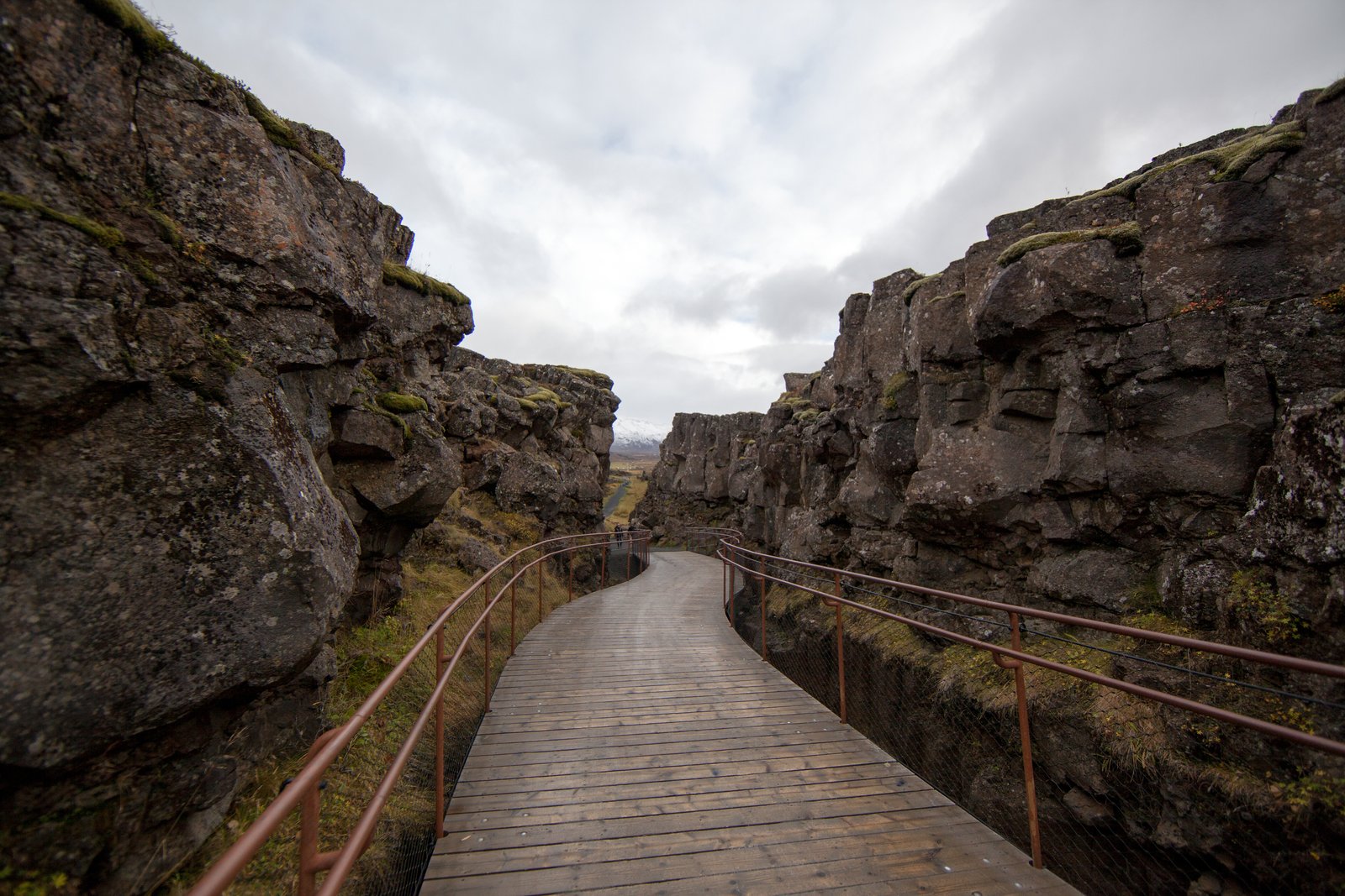 The boardwalk through Almannagja, the rift at Thingvellir. You are walking along
the edge of the North American plate.
The boardwalk through Almannagja, the rift at Thingvellir. You are walking along
the edge of the North American plate.
A flooded rift at Thingvellir where the North American and Eurasian plates pull apart, filled with glacial meltwater filtered through lava for decades. You can see about 100 metres through it. You snorkel it in a dry suit, floating over a crack between two continents.
The Blue Lagoon
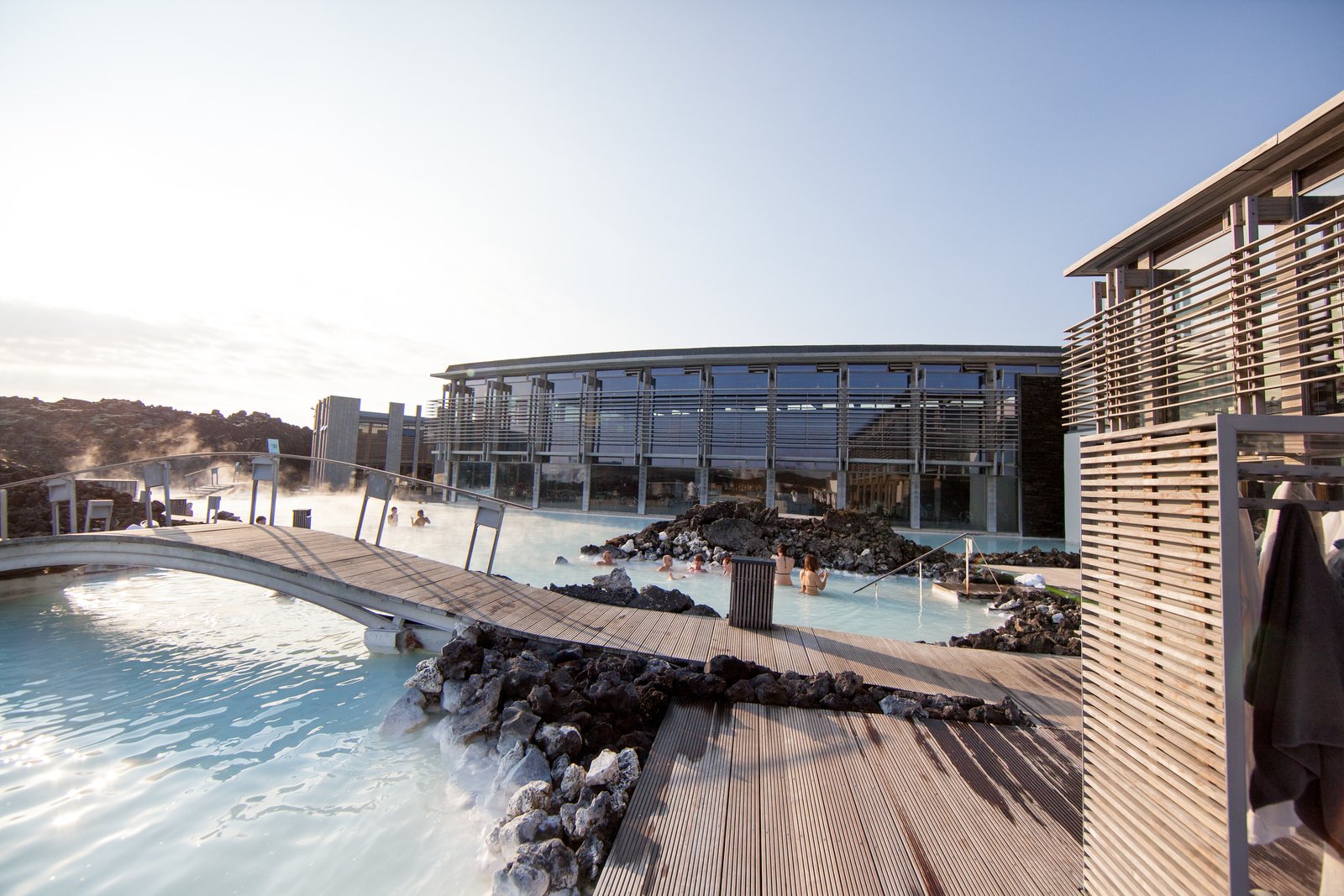 Late afternoon at the lagoon. Busy and expensive, and still the right way to end
the week.
Late afternoon at the lagoon. Busy and expensive, and still the right way to end
the week.
Milky blue silica water in a black lava field, twenty minutes from the airport, which is exactly why it works as the last stop before a flight.
It is also the stop that generates the most anxious questions now, because Reykjanes has erupted repeatedly since 2023. The short answer: the lagoon has stayed open the overwhelming majority of the time through all of it, with barriers, monitoring and a rehearsed evacuation plan. The most recent eruption ended in August 2025. Check the day before, book anyway.
What October gives you back
The season costs you the highlands. It hands you the sky instead.
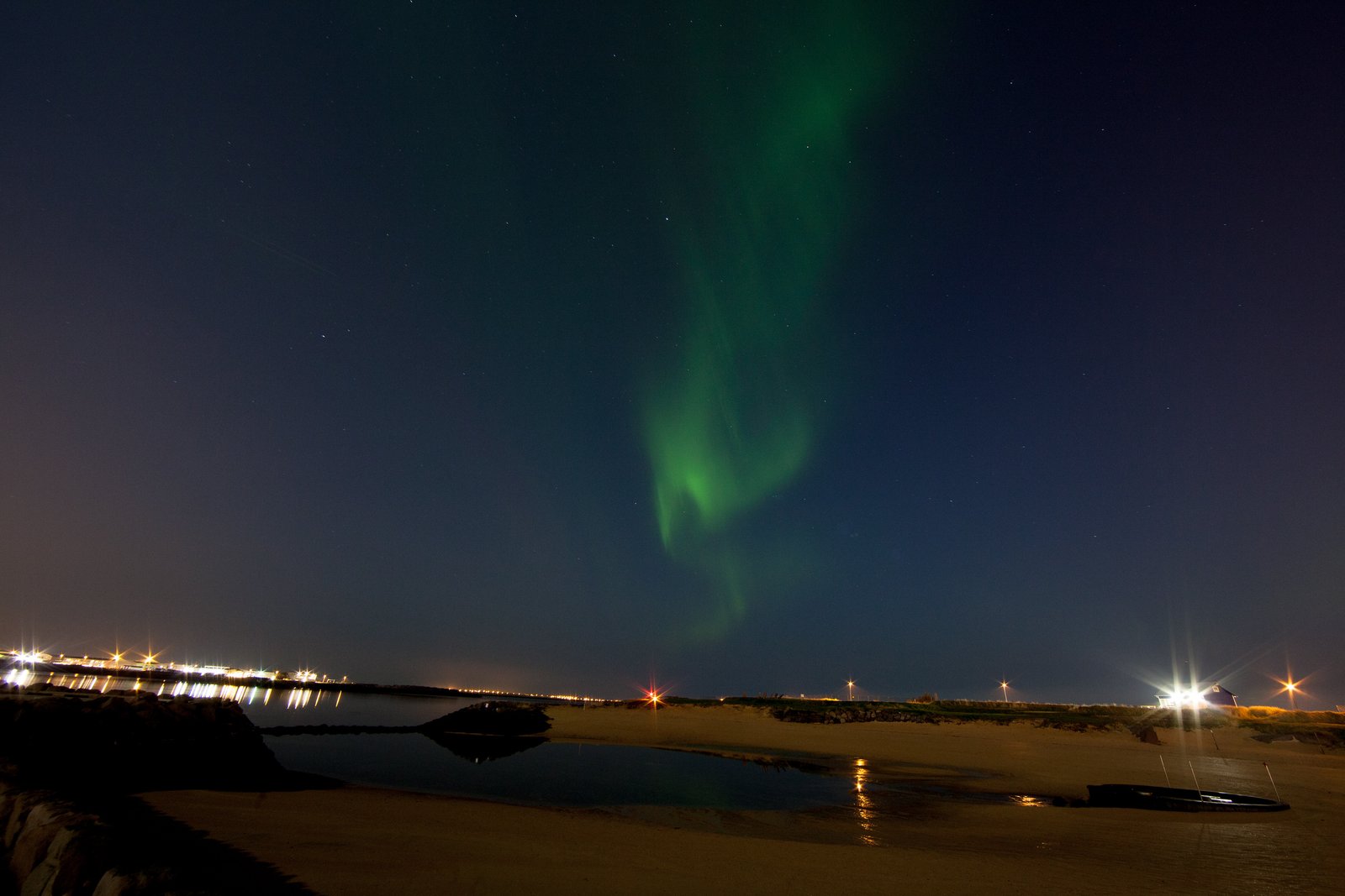 No tour, no tripod heroics. We walked down to the water on an ordinary night and
they were just there.
No tour, no tripod heroics. We walked down to the water on an ordinary night and
they were just there.
October is genuinely one of the better months of the season, not just a consolation prize. You get real dark nights, the equinox period tends to be active, and the ring road is still fully open, which is not something February can say.
Three lagoons, if you have the hours
The geothermal baths are the easiest thing to bolt onto this route, because three of them sit exactly where you already stop.
Vok Baths is on the lake at Egilsstadir, floating pools cut into it, at the end of day 4. Forest Lagoon is above Akureyri, at the end of day 5. Sky Lagoon is on the Reykjavik shore, twenty minutes from the centre, which fits either the first evening or the last.
One naming note, because it will confuse you when you search: day 5 of this itinerary is sold everywhere as the Diamond Circle. That is a marketing name for Asbyrgi, Dettifoss, Myvatn and Husavik. It is the same road.